While sediment texture describes the grain size composition, the sedimentary environment describes the processes controlling a certain location such as deposition or erosion. It defines the dynamics of the seafloor in LIS and, therefore, is important for identifying and understanding areas that are stable or changing. The sedimentary temporal and spatial record of these processes can be obtained from combining multibeam bathymetry, backscatter, subbottom, and sediment core information.
The following summarize the Sedimentary Environments topic. An overview of the Sediment Sampling program was reported in the Long Island Sound Study’s Sound Update in 2013 and can be found here: Sediment Sampling
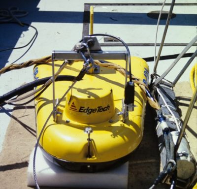
- Subbottom acoustic surveys collected over 1000 km of survey lines covering nearly all of the pilot area. Twenty-three sediment cores were collected by gravity corer with depths ranging between 45 and 200 cm at an average depth of 125 cm. Another 23 sediment cores were collected by a hydraulically damped corer with depths ranging between 15 and 52 cm at an average depth of 39 cm.
- Subbottom data provide information of the lateral extent of sub-surface layers and changes that enables first order interpretation of the sedimentary environment and allows extrapolation of more detailed information from sediment cores. In addition, subbottom data can also image details of previous anthropogenic changes such as pipelines, cables and dredge channels, which might yield insights on their effects on the environment.
- The high variability of the pilot study area results in many variations of the sedimentary environments. We distinguish several major groups of sediment environments (Depositional, Non-Depositional/Erosional, Dynamic).
- The combination of the different data sets provide insight into the dominant energy levels of the different areas. Based on the composition and type of sediments and layer structure observed in the sediment cores and subbottom data we distinguish High, Moderate/High, Moderate, and Low/Moderate, Low regimes.
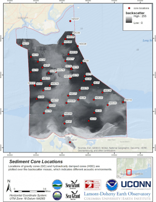
Location of sediment cores taken in the Phase I Pilot area by the LDEO team to characterize the sedimentary environments - Sediment cores are critical for identifying changes in environments including the temporal distribution of sediments. We found in many of the cores a dramatic change in the sedimentation within 10 to 20 cm down-core. This also means changes in depositional environments and possibly ecosystems within short-time spans. In contrast, some cores showed very similar sedimentation throughout time, which also reveals lack of change in the depositional environment. Developing a short-term chronology from the core data can significantly contribute to a better understanding of depositional processes.
- The pilot area is highly variable and there are locations where additional sediment cores would have been useful to determine the character of these areas, especially in boundaries between different types. At several locations, the deepest sediments recovered contained metal levels that were elevated above background levels. This is most notable in the northeastern section of the pilot area, where we were limited to using the hydraulically damped gravity corer due to weather conditions. Interestingly, we also observe metal concentrations that are higher than those in other areas and collecting additional, longer cores at some of these sites as part of later phases could be useful.
- Sediment environments and related information can be presented in various ways. In this report we offer several options that appear the most useful for us. The goal is to provide the results in different ways and with different degrees of interpretation to allow other users to integrate these results into a wide range of applications and decision-making processes.
These summary findings were extracted from and can be accessed by clicking on the Phase I Final Report.pdf and Appendixes.pdf.
These are also accessible from the Long Island Sound Study page found here: http://longislandsoundstudy.net/research-monitoring/seafloor-mapping