The following summarizes the results of the Habitat Characterization of the Phase I Pilot Area Final Report:
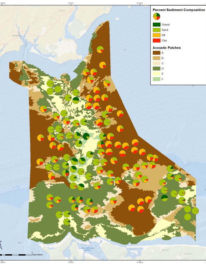
- Acoustic backscatter data derived from several NOAA surveys were effectively used to identify large scale seafloor elements that had specific ranges of acoustic image properties using image segmentation techniques. These elements are referred to as acoustic patch types, and six specific types were identified.
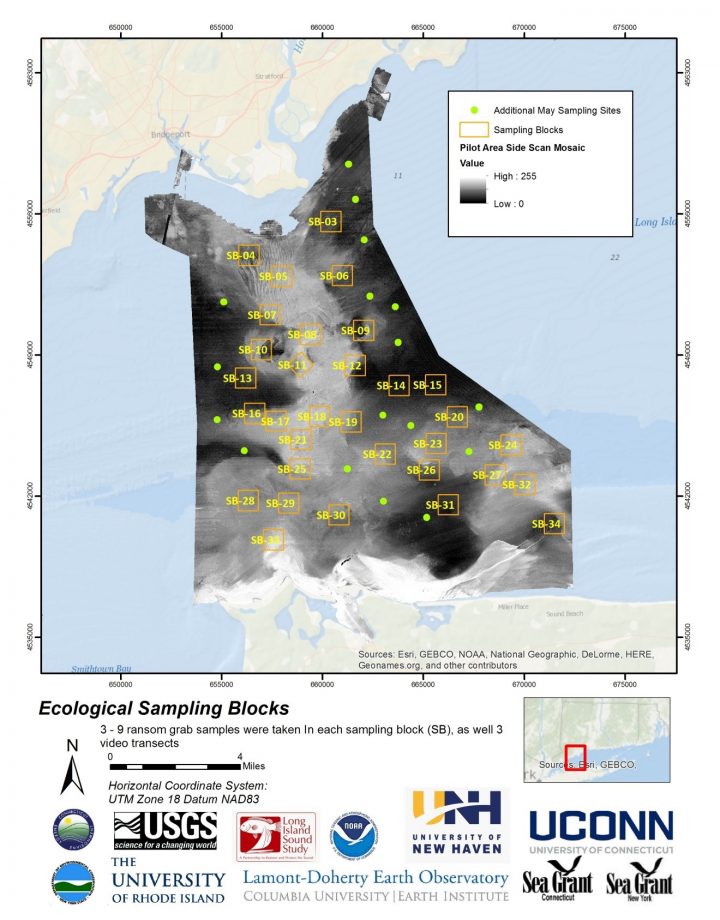
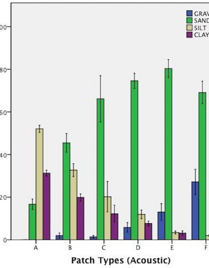
- The analysis of grab data from sediment sampling cuises in Fall 2012 and Spring 2013 provided the basis to assess the sedimentary characteristics (percent of gravel, sand, silt, clay) associated with the acoustic patch types comprising the seafloor landscape in the pilot study area. These analyses indicated that each acoustic patch type is associated with a distinct composition of each of these four general sediment types, but that there could be significant spatial variation within acoustics patch types. The six sedimentary compositions were Silt-Clay/Sand, Silt-Sand-Clay, Silty, Clayey Sand, Sand, Gravelly Sand, and Gravel-Sand.
- Several additional variables were used to characterize the acoustic patch types including bathymetry, terrain roughness index (TRI), bottom stress, and slope. These variables were used in addition with percent silt clay to identify and map potential habitat heterogeneity within acoustic patches.
- The analysis of the acoustic data and the identification of the large scale acoustic patch types (on the order of greater several km2) and the meso-scale sub-habitats (on the order of less than km2) within them provides several of the modifiers described in the habitat classification scheme proposed by Auster (2009) that can be incorporated into the classification of LIS. These can be integrated with additional modifiers including anthropogenic processes, chemical processes, and biological processes to further develop the classification scheme.
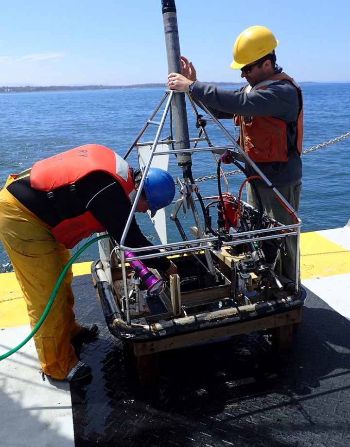
Here are some representative images from this section of the Final Report. Hover your mouse over the image to stop the scroll and see the caption.
The Final Report and Appendixes can be found here: http://longislandsoundstudy.net/research-monitoring/seafloor-mapping


