Phase I Acoustic Data Portal
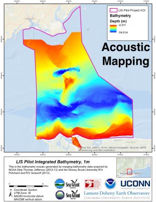
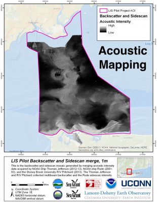
The table below provides the results of the acoustic element of the Phase I area Long Island Sound Cable Fund Habitat Mapping initiative, including links to the attendant metadata that provides the attributes and data acquisition details and explanations and links to download the data from the Lamont-Doherty Earth Observatory's Marine Geoscience Data System (MGDS).
Data Description |
Preview |
Metadata |
Download |
| Phase I area | |||
| Acoustics - Stony Brook University | |||
| Bathymetry for the Phase I area |  |
Bathymetry metadata | GeoTiff of Bathymetry from the Phase I area |
| Backscatter for the Phase I area |  |
Backscatter metadata | GeoTiff of Backscatter from the Phase I area |
| Raw EM3000D Acoustic Backscatter and Bathymetry Data acquired by the RV Pritchard | Raw Acoustic Backscatter and Bathymetry Data | ||
| Seafloor Images from the Phase III Area | LIS3A_LISMaRC_Images |