The table below provides the results of the Physical Oceanography element of the Phase II area Long Island Sound Cable Fund Habitat Mapping initiative, including links to the spatial data for locations of the sampling efforts along with the attendant metadata that provides the attributes and data acquisition details and explanations.
| Data Description | Preview | Metadata | Download |
|---|---|---|---|
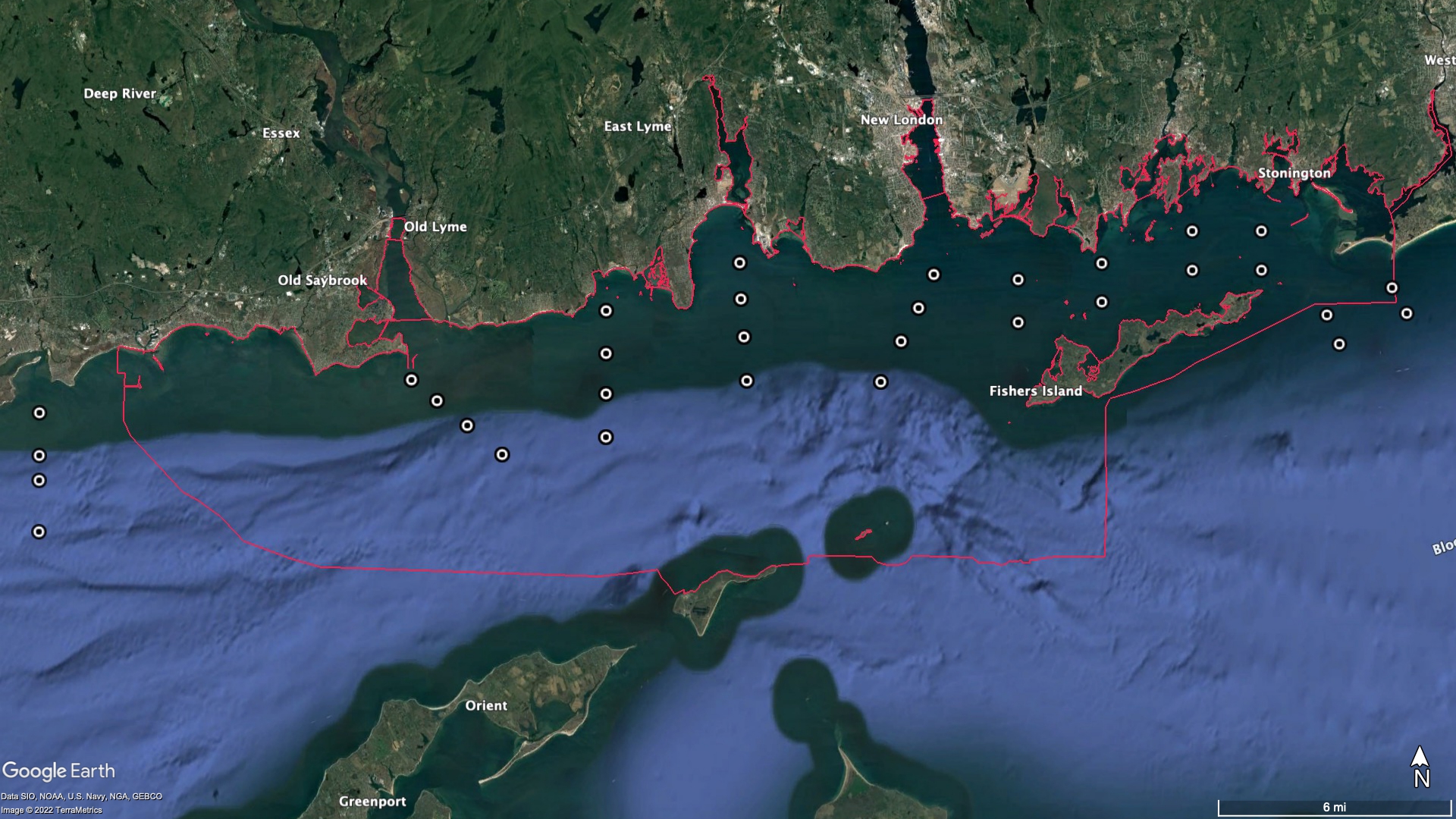
| Location of all physical oceanographic sampling 2017 – 2018
|
|
Physical oceanography sampling location metadata
.pdf file 3 MB |
Physical oceanography sample location log
.pdf file, 3 MB ESRI shapefile 2 KB ESRI .shp 3 KB |
|
CTD cast data 2017
|
 |
CTD cast metadata 2017
pdf file 98 KB |
Zip file of results of 2017 CTD cast data in .nc format
zip file 2 MB |
| CTD cast data 2018 | |
CTD cast metadata 2018
pdf file 98 KB |
Zip file of results of 2018 CTD cast data in .nc format
zip file 16 MB |
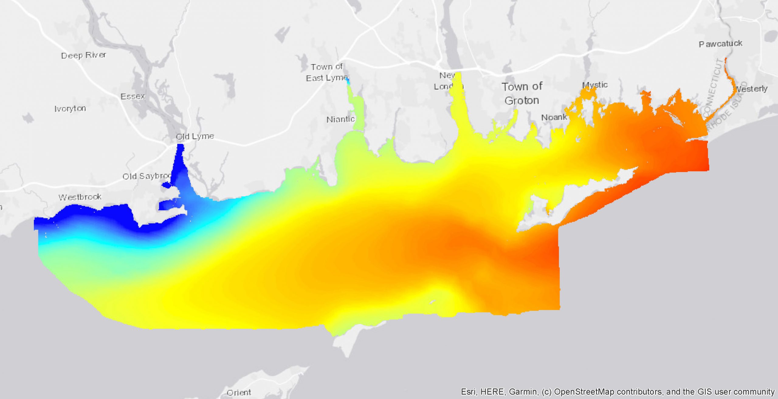
| Near bottom temperature & salinity model output | 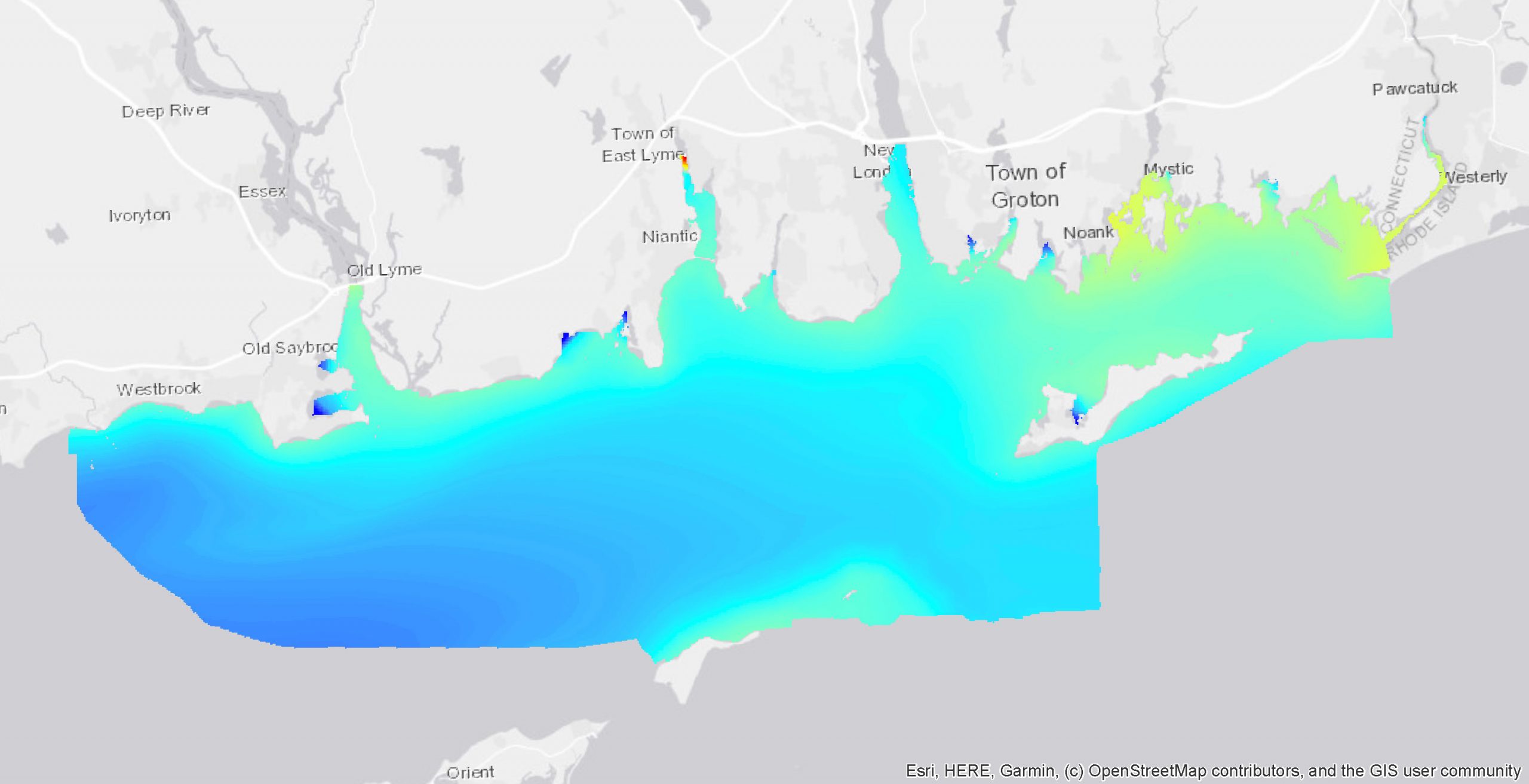
|
Near bottom temperature & salinity model output metadata
pdf file 586 KB |
Near bottom temperature model output map
ESRI .shp file 2 MB Near bottom salinity model output map ESRI .shp file 1 MB |
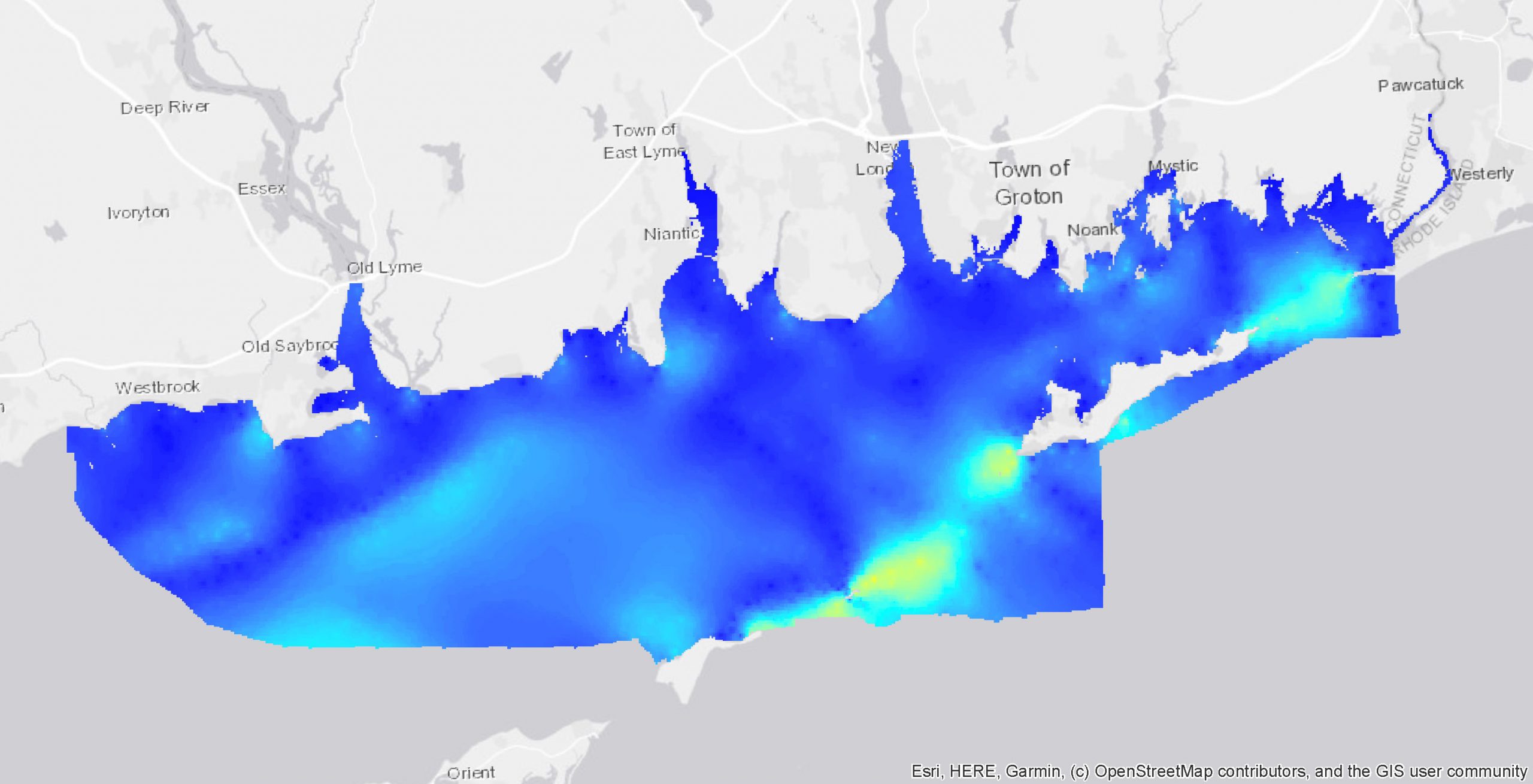
| Bottom stress & depth averaged current model output | 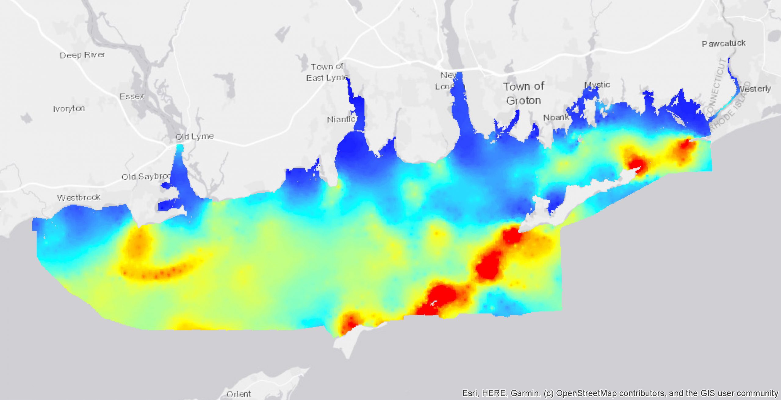
|
Bed stress & near bottom current metadata
pdf file 593 KB |
Bottom stress model output map
ESRI .shp file 7 Depth-averaged current model output map ESRI .shp file 1 MB |
| Teledyne RDI Up-looking ADCP data 2017 & 2018 | 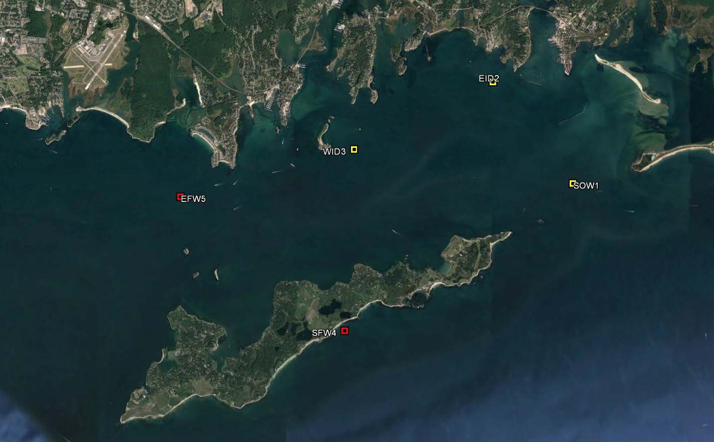 |
RDI ADCP Metadata | Link to RDI ADCP data on UConn Thredds server, data in .nc format |